Showing posts with label the wire. Show all posts
Showing posts with label the wire. Show all posts


01 August 2013
13 September 2010
Geography of The Wire, S2E01
This is a series of posts that attempts to locate the actual, real-world locations of some of the scenes filmed in the HBO series, The Wire. The locations are time-stamped screen captures compared with Google Maps/Street View images.
Clement Street Cafe, 27:03. It's a little difficult to make out in this screen capture, but the orange neon sign in the distance is the iconic Domino Sugars sign.
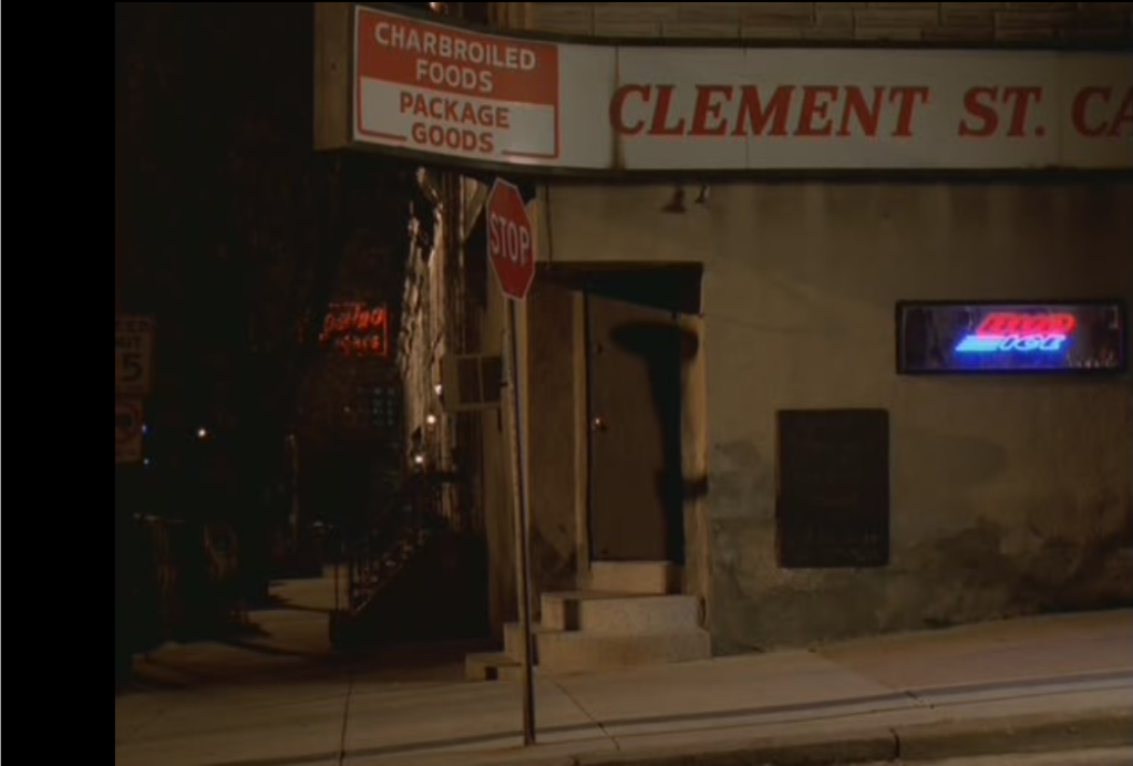 The Domino Sugars sign faces generally west, and if we follow a westerly direction from the sign, combined with the knowledge of Clement Street, brings us to the corner of E. Clement Street and Jackson Street on Locust Point. The bar is no longer there, but the corner door stands out. Also, the trees in the Google Street view obscure it, but if you travel a little further east down Clement Street, you can see the Domino Sugars sign.
View Larger Map
Rear of Nick Sobotka's parent's home, 33:33. The pattern to notice here is that the home he is leaving has one door with a security light and a small window, and the house to the left has a door and two small windows:
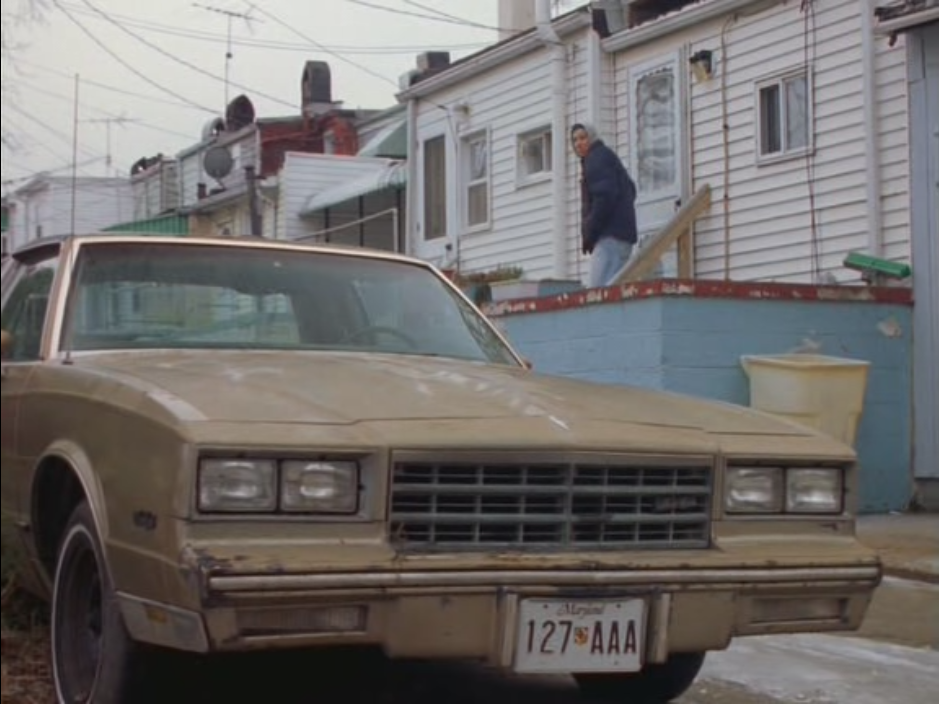 With later visual clues that indicate the house is in the immediate vicinity of the grain silo, it doesn't take much to find the actual location:
View Larger Map
Here is the rear of the same two houses; you can see the house that Nick is leaving on the right (with the small fence) and the house to the left with the door and two small windows. This is the rear of Reynolds Street, just a few houses up from E. Clement Street (although a different section of Clement Street from the cafe above).
Alley behind Nick Sobotka's parent's home, 33:56. This is a view of the same alley from the south, taking in the huge grain silo. Notice how the southern corner of the silo is roughly aligned with the right edge of the alley:
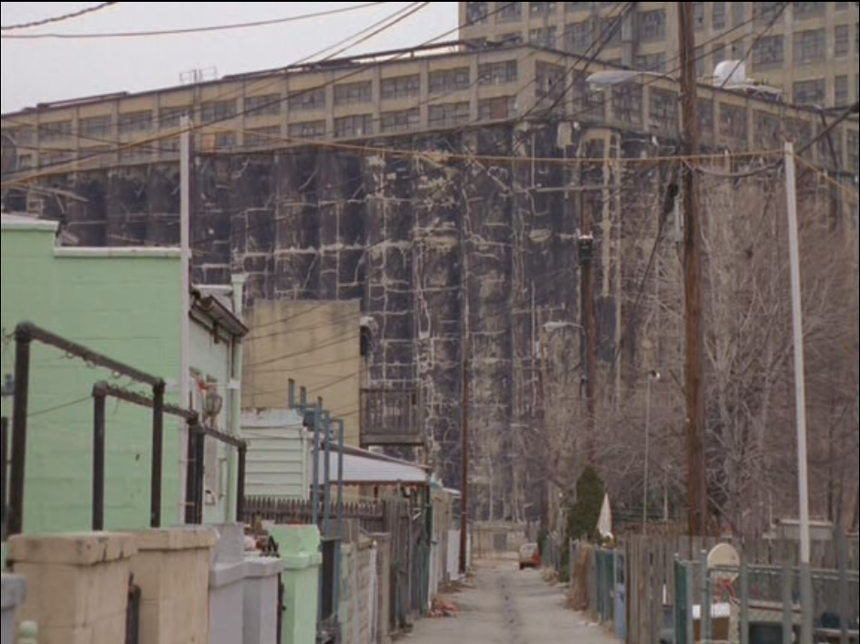 The conversion of the grain silo into the Silo Point Condos (which is alluded to at the end of Season 2) shows that considerable development has occurred since filming, but some parts of the building remain. Also, the building of the condominiums to the east of Reynolds Street completely changes the view. This is the view down the back alley of Reynolds Street:
View Larger Map
Fort Avenue Meeting, 38:15. Key indicators are the street sign (Fort Avenue), the sign above and to the right of the stop sign, and the crane in the distance:
 This capture is actually less than a block away from the previous one, looking south from Reynolds Street. Notice the sign (which is more visible on Google Street View) and the crane. It's also interesting to note how the filmers framed the shots to make the cranes appear much larger than then do in the "normal" view:
View Larger Map
Here is a close-up of the sign on the corner of Reynolds Street and Fort Avenue:
That's it for Season 2, Episode 1. If you have other locations that you're curious about, post a comment and try to get a screen capture or at least a timestamp and I'll see what I can find.
Clement Street Cafe, 27:03. It's a little difficult to make out in this screen capture, but the orange neon sign in the distance is the iconic Domino Sugars sign.
Rear of Nick Sobotka's parent's home, 33:33. The pattern to notice here is that the home he is leaving has one door with a security light and a small window, and the house to the left has a door and two small windows:
View Larger Map
Here is the rear of the same two houses; you can see the house that Nick is leaving on the right (with the small fence) and the house to the left with the door and two small windows. This is the rear of Reynolds Street, just a few houses up from E. Clement Street (although a different section of Clement Street from the cafe above).
Alley behind Nick Sobotka's parent's home, 33:56. This is a view of the same alley from the south, taking in the huge grain silo. Notice how the southern corner of the silo is roughly aligned with the right edge of the alley:
View Larger Map
Fort Avenue Meeting, 38:15. Key indicators are the street sign (Fort Avenue), the sign above and to the right of the stop sign, and the crane in the distance:
View Larger Map
Here is a close-up of the sign on the corner of Reynolds Street and Fort Avenue:
That's it for Season 2, Episode 1. If you have other locations that you're curious about, post a comment and try to get a screen capture or at least a timestamp and I'll see what I can find.
12 September 2010
Geography of The Wire, S3E01 (special)
This is a series of posts that attempts to locate the actual, real-world locations of some of the scenes filmed in the HBO series, The Wire. The locations are time-stamped screen captures compared with Google Maps/Street View images.
Consider the following screen captures from Season 3, Episode 1 of The Wire. In the first picture, we see the building on the far corner with the white front and red letters. It's the "Thank God for Jesus Church." Also note the gray siding and the white door with the air conditioner.
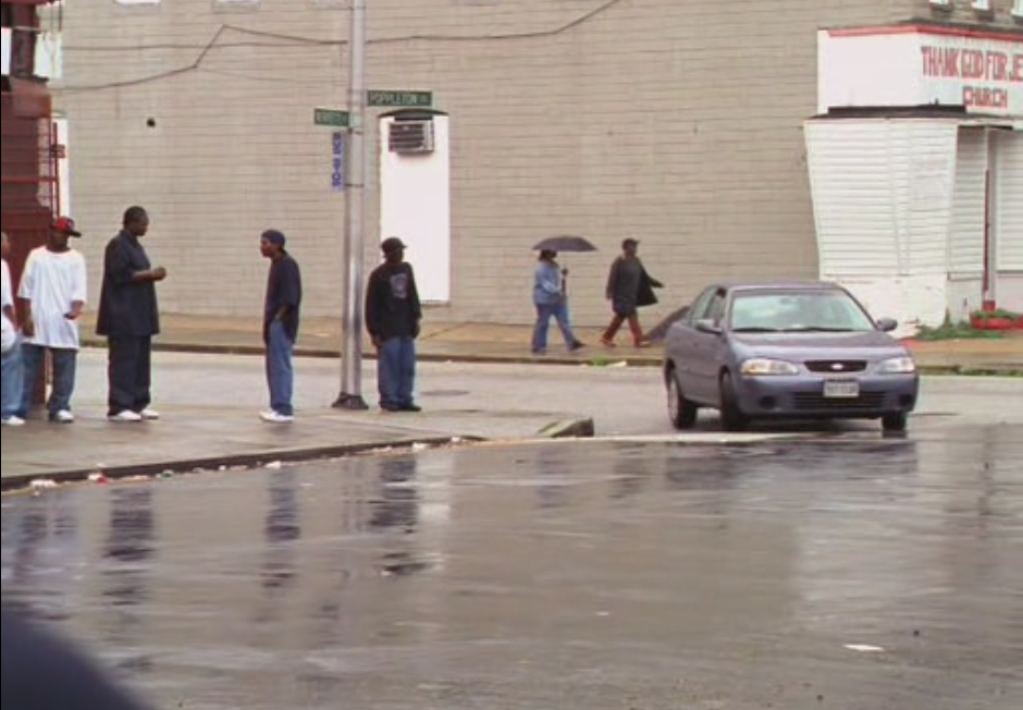
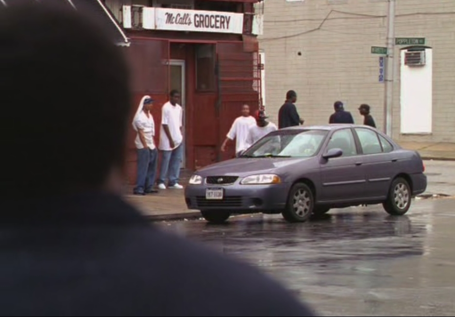 It turns out that McCall's Grocery doesn't exist (at least not anymore), but the Thank God for Jesus Church does exist:
View Larger Map
Note the distinctive white and red front, and door-mounted air conditioner. Let's back up a little bit and take a look at the near corner:
View Larger Map
There's our red store. So this is our corner, right? Yes, well, sort of. Google Maps identifies this intersection as N. Bond Street and E. Federal Street, which is in East Baltimore. However, take a closer look at the street sign from the original screen capture:
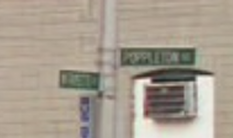 This indicates that the intersection is actually Poppleton Street and (I think) Fayette Street, which is squarely in West Baltimore. Street View of Poppleton and Fayette clearly indicates it is not the location.
Why does this matter? Well, realistically, it doesn't. But I thought it was interesting that during the filming they went as far as changing the street signs to indicate the location as West Baltimore rather than East Baltimore, even though it was unlikely that anyone would notice.
Consider the following screen captures from Season 3, Episode 1 of The Wire. In the first picture, we see the building on the far corner with the white front and red letters. It's the "Thank God for Jesus Church." Also note the gray siding and the white door with the air conditioner.
Now check out a few seconds later as the car comes around the corner. We see the near corner with "McCall's Grocery" fronting the red store:
View Larger Map
Note the distinctive white and red front, and door-mounted air conditioner. Let's back up a little bit and take a look at the near corner:
View Larger Map
There's our red store. So this is our corner, right? Yes, well, sort of. Google Maps identifies this intersection as N. Bond Street and E. Federal Street, which is in East Baltimore. However, take a closer look at the street sign from the original screen capture:
Why does this matter? Well, realistically, it doesn't. But I thought it was interesting that during the filming they went as far as changing the street signs to indicate the location as West Baltimore rather than East Baltimore, even though it was unlikely that anyone would notice.
Subscribe to:
Posts (Atom)